|
Infinivolve 2.0
- New Features
- Dynamic seismic shooting display. Infinivolve displays the shooting wave which is
generated based on the active shot point. The wave can be pragmatically controlled
to illustrate the duration (record length), shape and dimension of the shot template
in real time. [link for screen shot]
- Scalability based on the latest multi-core CPU technology. Infinivolve effectively
uses all the available cores to achieve the best performance.
- Satellite photo overlay. Infinivolve now supports overlaying a satellite photo on
its GIS map. Via a straight forward import wizard, users can quickly choose photo
file, specify photo location using latitude and longitude fields and show satellite
photo on top of the vector based GIS layers.
- Vehicle tracking history automatic playback. Users can choose to use the history
player to automatically playback vehicle movements vs. manually going through the
history.
- New GIS data layer for water body. The vector GIS layer represents the water bodies
in US. Along with the Stream layer, Infinivolve now provides detailed hydro information
to help survey professionals better manager survey activities.
- Free style location / vehicle tracking data import. Infinivolve now allows users
to import XML / csv / text format files and define data columns for positions, time
stamps, identifications, scales, etc. A user-friendly import wizard makes the data
import easy as 1-2-3. [link for screen shot]
- New earth skins. User can choose from three different earth skins, earth GIS (default),
earth thermal and earth night view. [link for screen shot]
- Key Enhancements
- Improved APIs for external layers. The simplified interface helps users link their
own layers more easily.
- Improved dynamic memory management. Infinivolve releases more memory when system
memory resource is high.
- Software acceleration support. Infinivolve now supports computers with only software
acceleration instead of the more powerful and popular hardware acceleration.
- Release schedule
- Beta version: 06/01/2011
- RC1: 07/05/2011
- RC2: 07/18/2011
- Final release: 08/01/2011
|

|
|
|
|
|
[US Map]
|
|
|
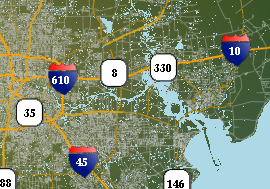
[City Map]
|
|
QUICK LINKS
|
|
|
HIGH LIGHTS
|
|
WHY MAP ENGINE IMPORTANT?
Two Major Trends
Two major trends – rising demand globally and depletion of current oil reserves. More…
CRUCIAL STEP
Map engine, which provides constant and real time seismic data updates, remains
the most crucial step of a successful geophysical survey. More…
NEW DEVELOPMENT
Map engine, which provides constant and real time seismic data updates, remains
the most crucial step of a successful geophysical survey. More…
Archive
|