|
Strength of Our Map Engine
Independence of constant data supply through Internet access
Often working in remote and scarcely populated area, geophysical survey professionals
face the constant challenge of communications. It puts most of the existing map
engines into a disadvantageous position. Depending on continuous data supply, these
map engines have to download GIS data on demand. Google Earth, for example, is an
online map display which requires live Internet connection to download the map data
constantly. If Internet connection fails, which is likely to occur in remote sites,
Google Earth cannot function properly.
The primary advantage of InfiniQuest’s map engine is its offline GIS map display
which has its own independent local data source. Offering survey staff a stable
and reliable flow of map data, this critical feature makes InfiniQuest’s map engine
a powerful choice for Geophysical survey professionals.
Dynamic data set on a large scale
Another hurdle facing geophysical survey displays is that the survey data can be
large and dynamic. In today’s market, some of the existing GIS maps are able to
display offline content but in a relatively small area. For example, roads, water
bodies, interesting points of an area of 2x2 square miles. However, the size of
geophysical surveys is increasing rapidly. It demands displays to cover much larger
areas with more details.
For example, a seismic data acquisition system for a geophysical survey can have
up to 100,000 sensors, each of which can transmit status updates at any time. Furthermore,
all the updates need to be presented on the map in real time. Currently, no existing
GIS map engine and / or application can handle both offline GIS map display along
with dynamic data set on such a large scale. The InfiniQuest’s map engine displays
static GIS data on the scale of national level, along with dynamic data set up to
100,000 points changing on a millisecond basis.
|

|
|
|
|
|
[US Map]
|
|
|
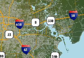
[City Map]
|
|
QUICK LINKS
|
|
|
HIGH LIGHTS
|
|
WHY MAP ENGINE IMPORTANT?
Two Major Trends
Two major trends – rising demand globally and depletion of current oil reserves. More…
CRUCIAL STEP
Map engine, which provides constant and real time seismic data updates, remains
the most crucial step of a successful geophysical survey. More…
NEW DEVELOPMENT
Map engine, which provides constant and real time seismic data updates, remains
the most crucial step of a successful geophysical survey. More…
Archive
|